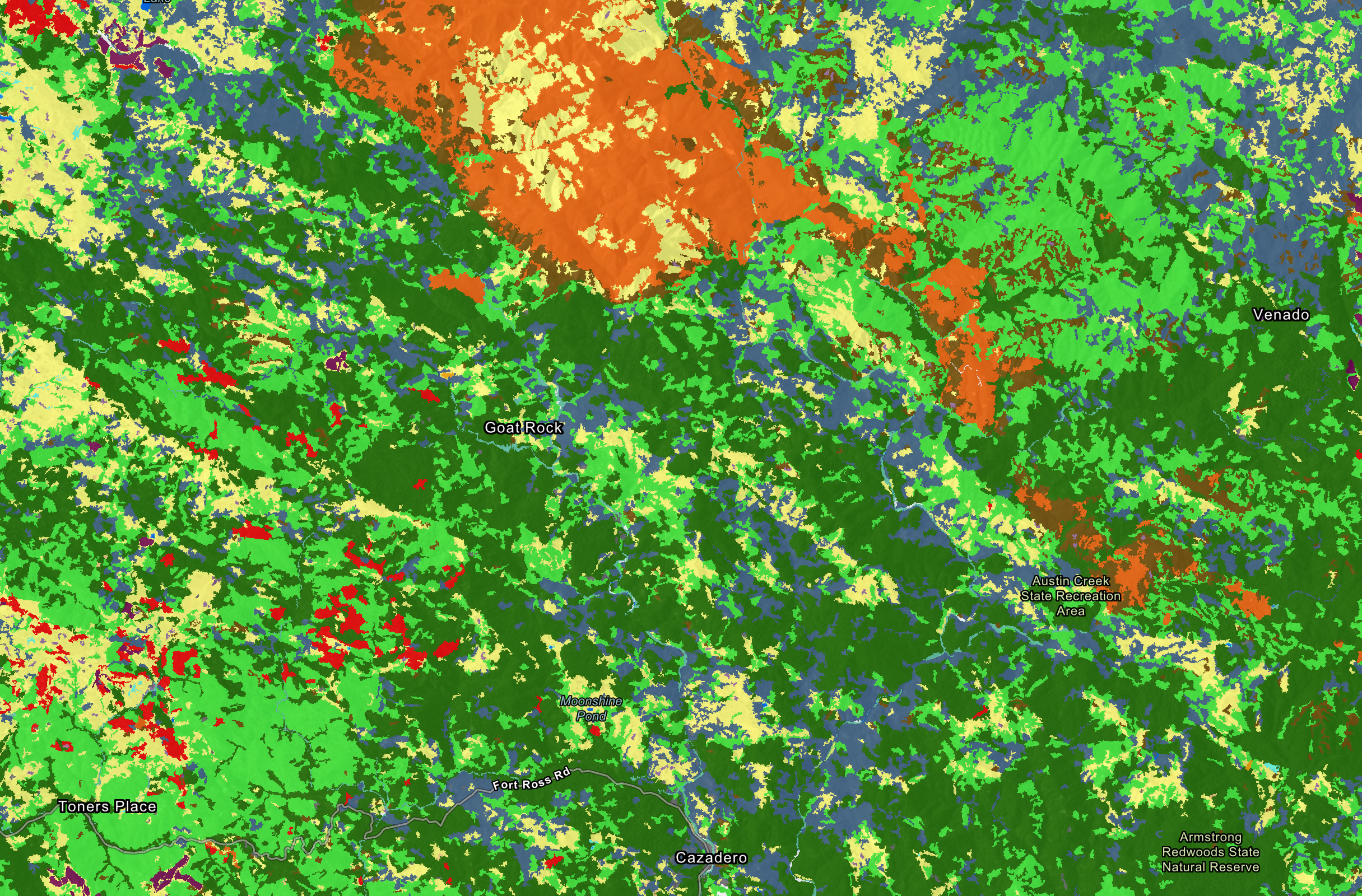
This map is a conglomeration of fine scale vegetation maps and for San Mateo, Marin and Sonoma Counties. The San Mateo and Marin maps represent the state of the landscape in summer, 2018 (pre CZU fire). The Sonoma map represents the state of the landscape in late 2013.
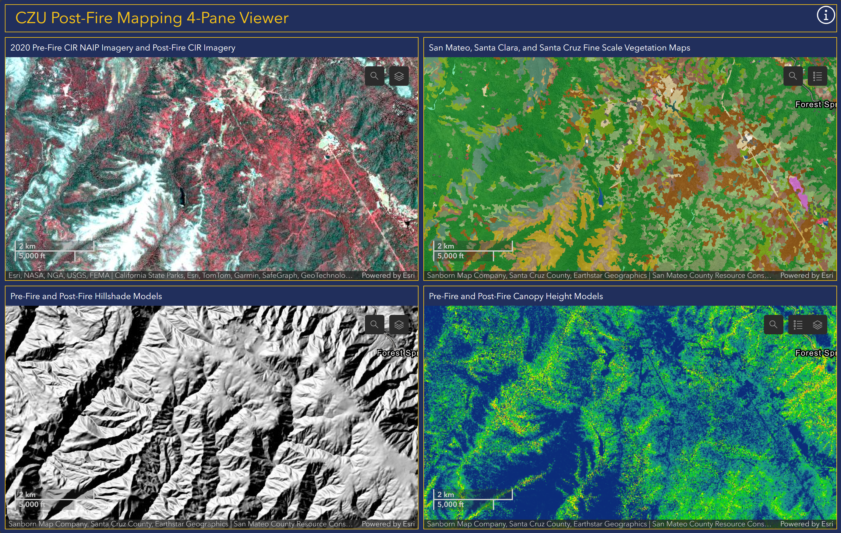
The CZU Post-Fire Mapping 4-Pane Viewer simultaneously presents 4 different linked map panes of the CZU complex fire area in San Mateo and Santa Cruz counties. All datasets featured in this 4-Pane viewer can also be viewed in the Pacific Veg Map Web App.
The clip and email viewer lets you digitize a polygon of less than 3,000 acres and sends you an email with lidar derived contours for that polygon. This works for the following counties: Del Norte (partial), Humboldt (partial), Lake, Marin, Mendocino, Modoc, Monterey, Napa, Sonoma, San Benito, San Luis Obispo, San Mateo, Santa Cruz, Santa Clara, Solano, and Trinity counties.
Del Norte (partial), Humboldt (partial), Lake, Marin, Mendocino, Modoc, Monterey, Napa, Sonoma, San Benito, San Luis Obispo, San Mateo, Santa Cruz, Santa Clara, Solano, and Trinity counties
The Post-CZU Fire Web Map allows users to compare pre- and postfire landscape conditions in the 2020 CZU Lightning Complex fire footprint. It includes imagery and LiDAR-derived canopy structure data from before and after the fire.
The San Mateo Veg Map Web App is designed for online viewing of the San Mateo County Fine Scale Vegetation map, a 106-class vegetation map of San Mateo County.
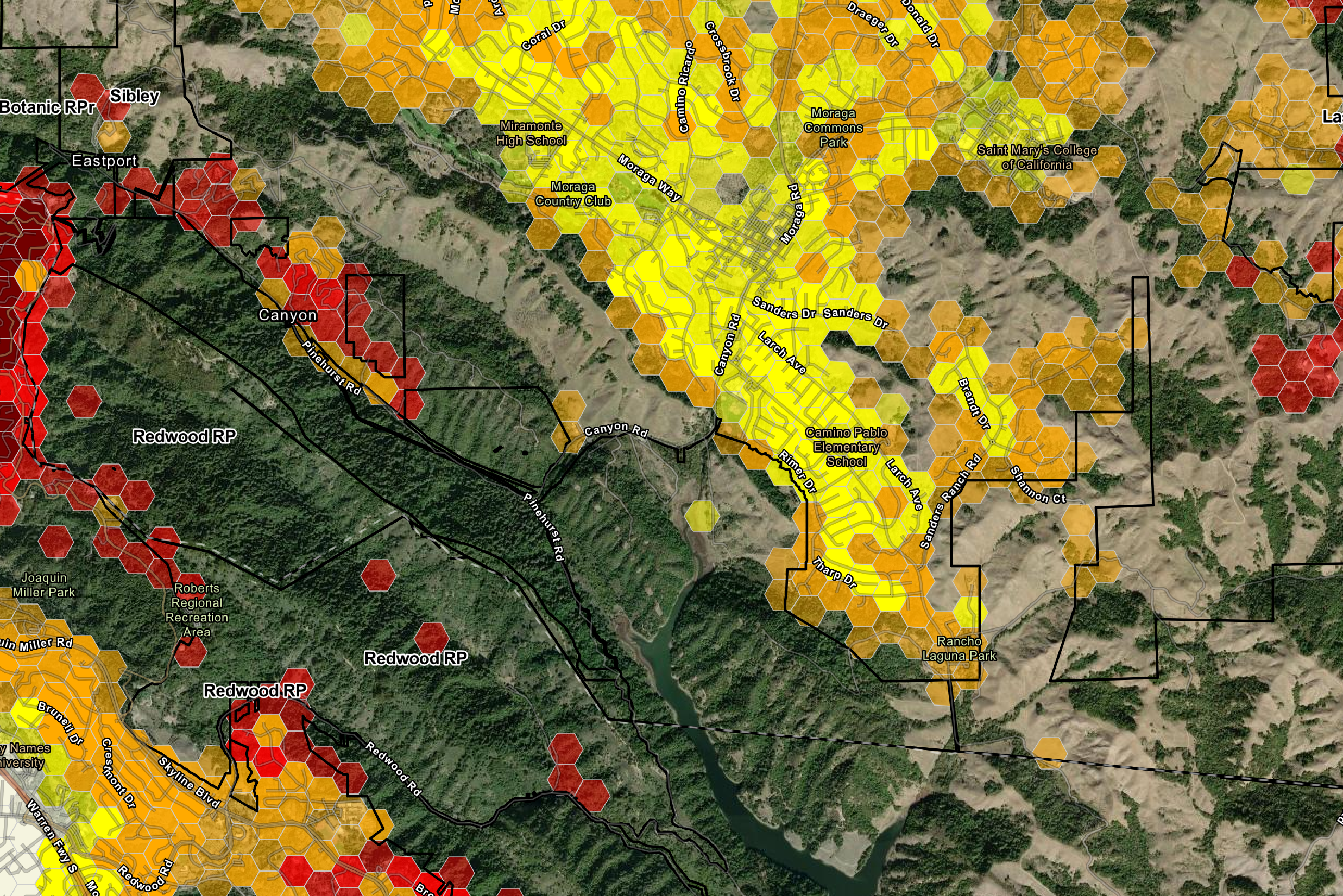
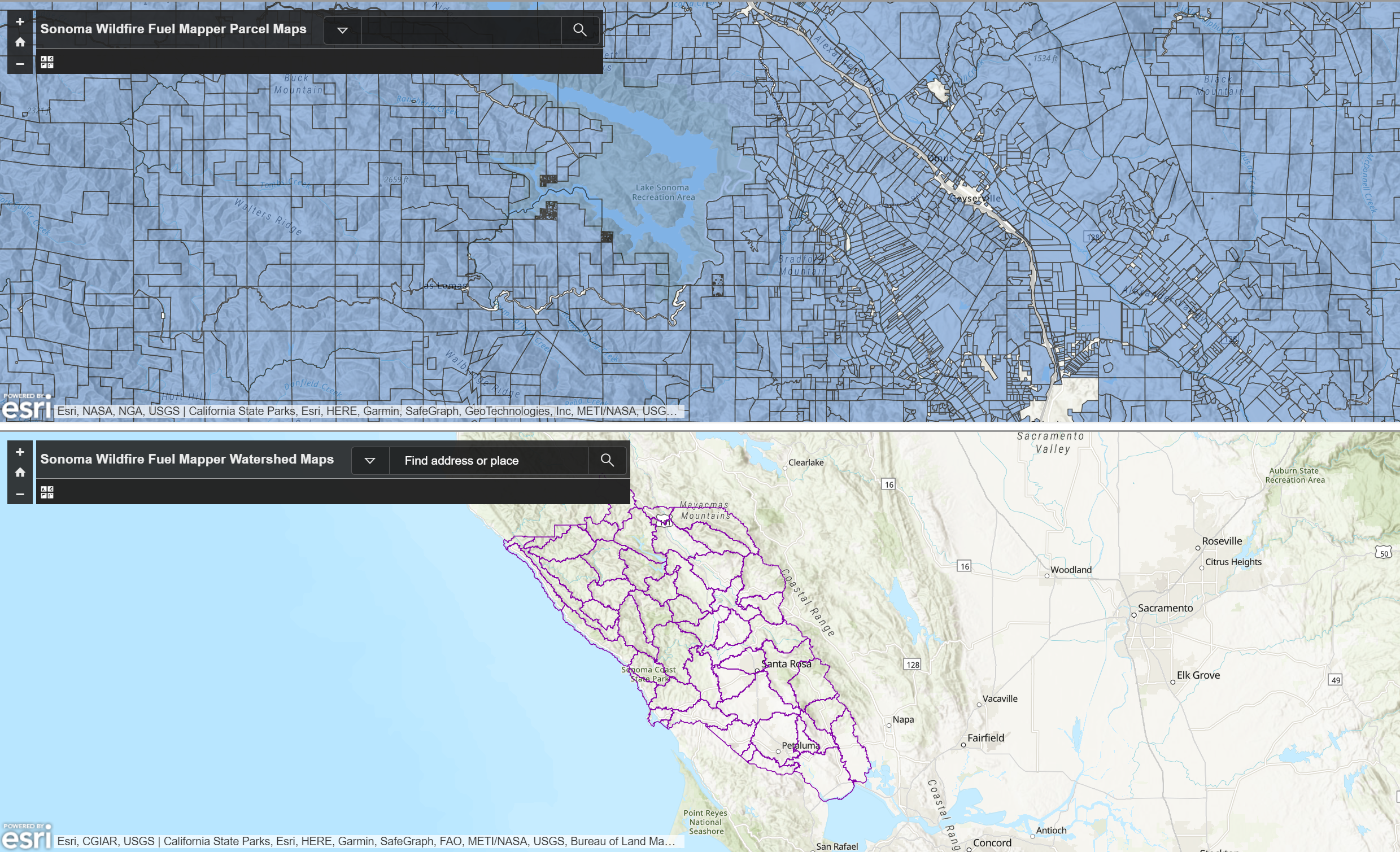
The Wildfire Fuel Mapper was created to help landowners and managers in locating and understanding fire hazards on their land, providing users with a set of tools, resources, and information to help landowners and managers reduce fire hazards. The Wildfire Fuel Mapper can also be utilized by professionals to support their clients in planning vegetation management projects.
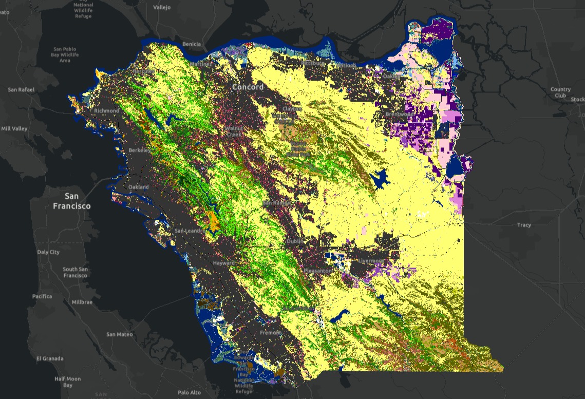
Sonoma County, Napa County, Alameda County, Contra Costa County
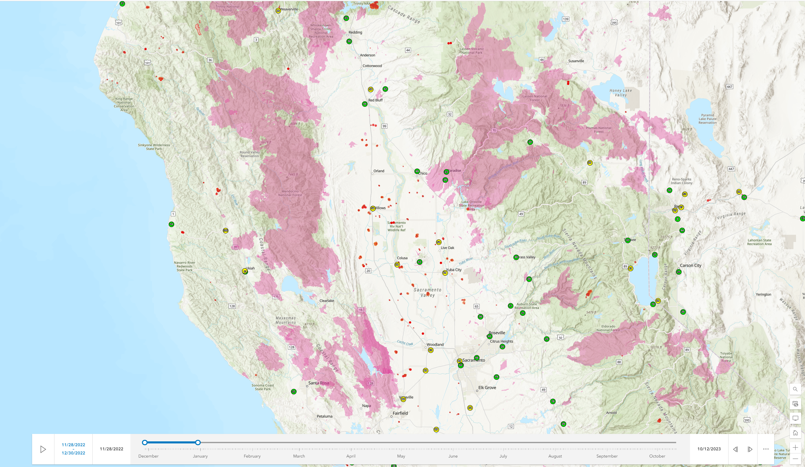
This web map allows users to view current and recent wildfire activity, air quality conditions, and building locations. It includes ESRI current wildfires, fire cameras, VIIRS + MODIS thermal hotspots from NASA, CALFIRE facilities, building locations, and AirNow air quality data.
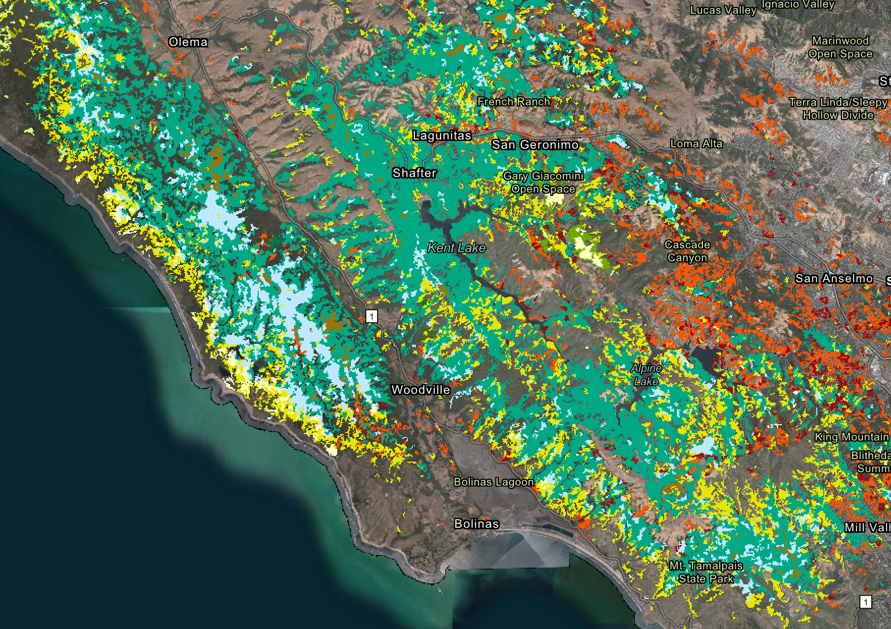
The Pacific Veg Map Web App provides a non-GIS user with web browser map access to a number of vegetation, topography, fire and fuels, and forest datasets for Bay Area Counties. For a view of select San Francisco Bay Area landcover data, see the Pacific Veg Map 4-Pane Viewer.
Sonoma County, Marin County, Napa County, San Mateo County, Santa Cruz County, Santa Clara County, Alameda County, Contra Costa County
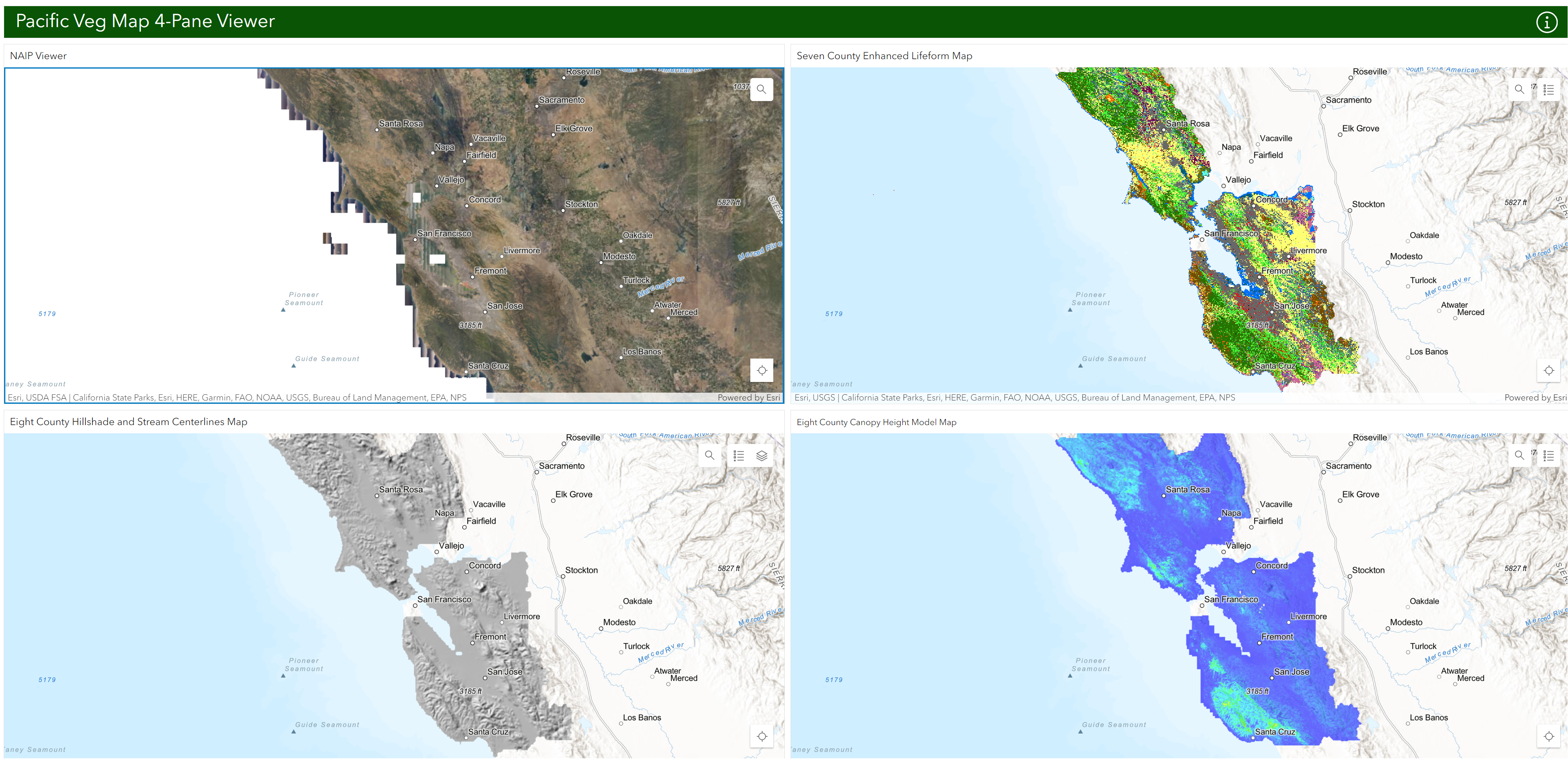
This Pacific Veg Map 4-Pane viewer simultaneously presents 4 different linked map layers of the San Francisco Bay Area. These maps highlight foundational San Francisco Bay Area GIS data. See the Pacific Veg Map Web App for all publicly available web data found on Pacific Veg Map.
Sonoma County, Marin County, Napa County, San Mateo County, Santa Cruz County, Santa Clara County, Alameda County, Contra Costa County